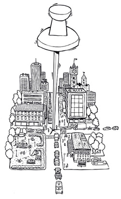
Citizens are invited to express their views or proposals by putting a marker in a spot, mark a stretch of road or a whole area on the map.
With the aid of the GeoPanel you can e.g. ask the questions: “Where is it safe to walk?” or “Where should we build a playground?” The marking on the map can also be connected to a written comment on the motives for the marking. All the answers have a geographical connection, and can be analysed in a GIS (Geographic Information System) in your municipality or organisation. Do not ask too many or too complicated questions. Try the questionnaire on a test group before sending it out. The GeoPanel allows many to contribute views and proposals irrespective of time and space. The gathered information can be compiled without any additional input – if you use a GIS map as a basis, the answers can be matched against various layers of the GIS system. The maps used in a web enquiry could also be printed and used in physical meetings. Access to good maps is a necessity for using the GeoPanel fully. This method can be used for an unlimited number of participants, but it requires access to the Internet. It requires well-reasoned questions – answering should be so simple that it takes a maximum of 15 minutes. Costs may vary depending on which competences are available within the organisation and how much consult time has to be purchased. (SALAR)
With the aid of the GeoPanel you can e.g. ask the questions: “Where is it safe to walk?” or “Where should we build a playground?” The marking on the map can also be connected to a written comment on the motives for the marking. All the answers have a geographical connection, and can be analysed in a GIS (Geographic Information System) in your municipality or organisation. Do not ask too many or too complicated questions. Try the questionnaire on a test group before sending it out. The GeoPanel allows many to contribute views and proposals irrespective of time and space. The gathered information can be compiled without any additional input – if you use a GIS map as a basis, the answers can be matched against various layers of the GIS system. The maps used in a web enquiry could also be printed and used in physical meetings. Access to good maps is a necessity for using the GeoPanel fully. This method can be used for an unlimited number of participants, but it requires access to the Internet. It requires well-reasoned questions – answering should be so simple that it takes a maximum of 15 minutes. Costs may vary depending on which competences are available within the organisation and how much consult time has to be purchased. (SALAR)


 RSS Feed
